Last updated: November 2026
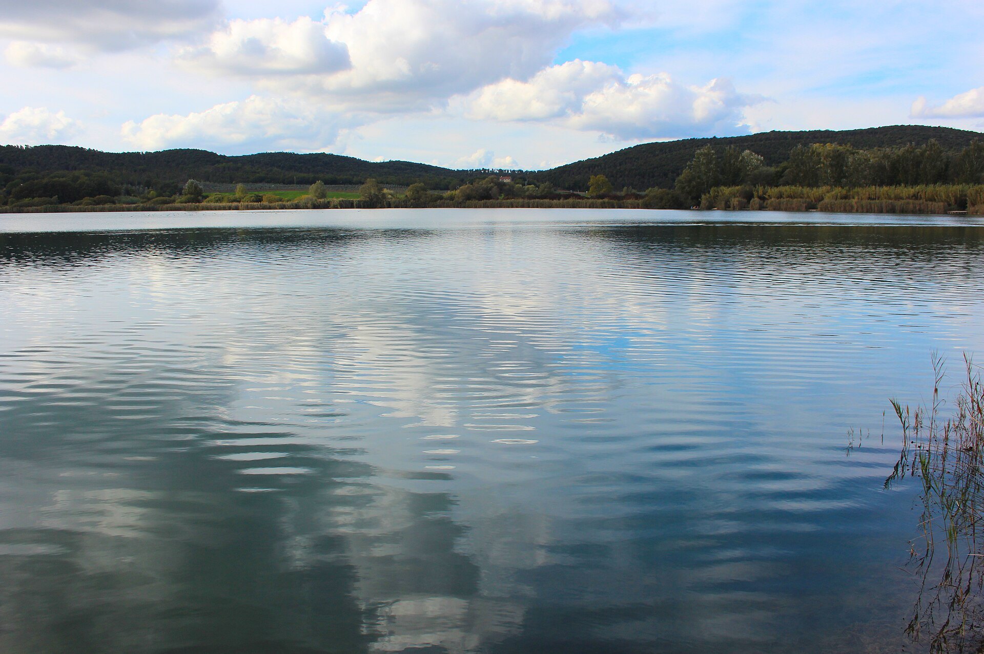
People come to Tuscany for the hills, and then they’re surprised to find lakes. Some are old wetlands full of birds. Some are mountain reservoirs with a village under the water. A couple are proper swimming lakes, with water that’s actually checked.
I lived in the hills above Pescia, so the ones I know best are in the north: Massaciuccoli out towards the sea, and the mountain lakes of the Garfagnana. The others I’ve visited or checked against official sources. Hours and rules change, so always check before you go.
The short version
- Official swimming lakes in 2026, on the regional bathing list: Lago dell’Accesa near Massa Marittima, and Lago di Bilancino in the Mugello. The region’s environment agency, ARPAT, monitors the water there in the bathing season.
- For birds and walks: Massaciuccoli, Lago di Chiusi and Lago di Montepulciano. These are nature reserves. Don’t plan on a dip.
- The one with the drowned village: Lago di Vagli in the Garfagnana. The village of Fabbriche di Careggine last appeared in 1994. No official date has been set for the next draining.
- Best season for a swim: June to September, and earlier in the day in August, when the car parks fill up.
- Best for a walk: spring and autumn, when the birds are moving and it’s quieter.
Bathing list checked against ARPAT, November 2026. Local rules can change from one summer to the next.
Can you swim in Tuscany’s lakes?
Only a handful are official inland bathing areas. For 2026, ARPAT lists parts of Bilancino, Accesa, the little quarry lakes at the Renai near Florence, Lago Braccini near Pontedera, and the warm spring pool at Calidario in Venturina, which I’ve already written about in my hot springs guide.
On other lakes, the water isn’t regularly tested for swimming. People do paddle, but I won’t tell you to. If a sign says no bathing, take it seriously, especially on reservoirs.
Lago dell’Accesa, near Massa Marittima

This is the swimming lake I’d drive to. It’s a natural, clear lake about nine kilometres south-east of Massa Marittima, in the Colline Metallifere, at a place called La Pesta. The comune says it’s around 20 to 38 metres deep, so it isn’t a paddling pool. There are marked ways down to the water, a path you can walk or cycle, and in summer it can be very busy, especially on Sundays in July and August.
The 2025 ARPAT classification, based on the 2022 to 2025 seasons, rated the water excellent. There’s no permanent lifeguard, so you swim at your own sense. The comune has, in recent summers, banned driving and parking on the land around the shores. Use the proper car park at La Pesta, which you’ll reach before the little restaurant, and don’t camp or light fires. Dogs are usually allowed on a lead, but often can’t go in the water from mid-June to mid-September. Check the current comune notice before you go.
Just across a small bridge and along a short avenue of eucalyptus is the Parco Archeologico dell’Accesa. The Etruscans lived and worked here from at least the seventh and sixth centuries BC, in settlements tied to the copper mines in the hills, probably under the eye of Vetulonia. You can see the foundations of houses, with panels to explain them. Entry is free. The museums in Massa Marittima ask you to download the Accesa+ app before you arrive, because the signal is poor. The park isn’t accessible for wheelchair users.
How to get there: you’ll want a car. From Massa Marittima it’s about 15 minutes on the SP49 to La Pesta. From Grosseto, allow around 45 minutes. There isn’t a useful bus to the lake itself. Arrive in the morning in high summer if you want a space in the car park.
Best time: June, or September, when you can swim and still find a bit of quiet. Midweek is kinder than a Sunday in August.
If you book through this link I may earn a small commission, at no extra cost to you.
Lago di Bilancino, in the Mugello

Bilancino is a reservoir, built in the 1990s to hold drinking water for Florence, in the comune of Barberino di Mugello. It’s the easiest official swimming lake if you’re coming from the city: off the A1, in the Mugello, with pebble beaches, a cycle path, and a sailing club. In the 2026 season ARPAT listed four bathing areas, including Nebbiaia Est, Pretaglia, Riva Nord and Sieve, and the water was classed excellent or suitable at the last tests in September.
The bathing season usually runs from May or June to the end of September. Swim only in the marked areas, and follow the signs on the day, because the comune sets the exact zones each year. Nebbiaia is the most equipped stretch, with a bar and pedalo hire in summer. Cavallina, Labbia and Fangaccio/Moriano are quieter pebble beaches with parking nearby. The comune’s 2026 lake rules also cover fishing, boats and where you can and can’t go.
How to get there: by car, leave the A1 at Barberino, then follow signs for the lago. From Florence it’s about 40 minutes, traffic willing. There are buses from Florence towards Barberino and the Mugello, but a car (or a bike, if you’re keen) makes the beaches much easier. Parking is signed at the main beaches; it fills up on hot weekends.
Best time: late spring and early autumn for a walk or a cycle, summer for a swim. It’s a good half-day if you’re staying in Florence and want water without the coast.
If you book through this link I may earn a small commission, at no extra cost to you.
Lago di Massaciuccoli, between Viareggio and Massarosa

This is the big, shallow lake behind the Versilia coast, an old lagoon that never quite became sea. Puccini had his villa at Torre del Lago, looking across the water, and wrote a good deal of his later work there. The lake itself is for birds, boats and a wooden walk, not for swimming, and it isn’t on the official bathing list.
The best way onto the water is the Oasi LIPU at Massaciuccoli, on the eastern shore, in the Parco di Migliarino, San Rossore e Massaciuccoli. The reserve, also called the Riserva naturale del Chiarone, has a visitor centre, a boardwalk of about 600 metres through the reeds, and hides for watching herons, egrets and marsh harriers. LIPU says the boardwalk and hides are accessible for wheelchair users, which is rarer than it should be in this part of Italy. They also rent canoes and quiet electric boats, and run guided trips. The wooden walk itself is free to wander.
When I last checked, LIPU gave opening hours of 9am to 6pm, every day, all year, at Via del Porto 154, Massaciuccoli. There’s a small car park, about twenty spaces, so it can fill. Do check the oasis website or ring +39 0584 975567 before you set out, because hours can shift.
How to get there: by car, it’s signed from Massarosa and from the A11/A12 area around Viareggio. By train, get off at Viareggio or Torre del Lago Puccini and take a local bus or a taxi to the oasis or the villa. You can also cycle the paths behind the beach, then cut inland. I’ve written more about this stretch of coast in my Versilia beaches guide.
Best time: spring and autumn for the birds. In summer go early, and take a hat. Winter can be beautiful and almost empty, if you don’t mind a grey day.
Lago di Vagli, and the village under the water

Lago di Vagli is a hydroelectric reservoir in the Apuan Alps, in the comune of Vagli Sotto. When it was filled in the early 1950s, the village of Fabbriche di Careggine went under the water. It has come back only when the lake was emptied for dam works: in 1958, 1974, 1983 and, last of all, in 1994. Since then the draining has been announced and postponed more than once, including a regional plan that would have seen it in 2024.
As of October 2026, there was still no official date. Local papers have talked about 2027 or 2028, sometimes in connection with the renewal of the plant’s concession, and just as often someone who knows the valley has said it may not happen at all, because the work can now be done with the lake full, and because the water is needed downstream. If you want to know whether the village will appear, watch the Regione Toscana notices and Enel, not the headlines. It takes weeks of draining before you could walk the old streets, and parking would be a serious problem if it ever does happen.
In the meantime the lake is worth the drive anyway. There’s an older footbridge, the Ponte Morandi, designed in the 1950s by the engineer Riccardo Morandi and about 122 metres long, which links Vagli Sotto to the far shore. A newer rope bridge, with a stretch of glass floor, is run as a paid attraction by VagliPark, along with a zip line. Check vaglipark.it for tickets and whether it is open, especially in winter. The lake is not an official bathing area.
How to get there: a car is really the only comfortable way. From Castelnuovo di Garfagnana it’s a winding climb of about 25 minutes. From Lucca allow an hour and a half, and don’t be in a hurry on the mountain road. Park in the village and walk. The Garfagnana guide will help you plan the rest of the day.
Best time: late spring to October, on a clear day, when the mountains stand up behind the water. After rain the road needs care.
If you book through this link I may earn a small commission, at no extra cost to you.
Lago di Gramolazzo and Isola Santa

A little further north, still in the Garfagnana, Lago di Gramolazzo sits under the Apuan Alps at the village of the same name, in the comune of Minucciano. It’s another Enel reservoir, made in the last century, and its water eventually feeds Vagli. The comune has built a lakeside park on the left bank, with a level cycle and walking path, picnic places, a small beach and a jetty. They say the walk is accessible, with no architectural barriers, which is worth knowing if steps are a problem.
It is not on the official bathing list, so the water isn’t regularly tested the way Accesa and Bilancino are. It’s a lovely place for a picnic and a walk, with the mountains in your face, and in summer you’ll find other people in the water. I leave that choice to you.

Not far away is Isola Santa, a tiny stone hamlet on its own green lake, in the comune of Careggine. It’s one of the prettiest stops in these mountains, and a gentle place to walk rather than a day at the beach. I always think it looks like a toy village that someone set down carefully in the woods.
How to get there: again, a car, via Castelnuovo or Piazza al Serchio. The roads are narrow and slow, and that’s part of the point.
Lago di Chiusi and Lago di Montepulciano

Down in the south, in the Valdichiana, two shallow lakes lie almost in a line between Chiusi and Montepulciano. They’re old, reedy and full of birds, and neither is an official swimming lake.
Lago di Chiusi sits just north of the town, almost on the Umbrian border. Locals sometimes call it the Chiaro di Luna. You come for a walk on the shore, for fishing, and, in season, for a canoe or a small boat. Visit Chiusi lists canoe trips from about April to November, but you should book and check, because it depends on the water and the weather. The town itself is a good place for lunch, and the railway station, Chiusi-Chianciano Terme, makes this one of the easier lakes to reach without a car, with a taxi or a short drive from the station.

Lago di Montepulciano is a regional nature reserve of reed beds, herons and a visitor centre, a little way down the hill from the town. There’s an electric boat trip of about 50 minutes on some Sundays, and hides for birdwatching, including a viewing tower. The reserve’s own site is the place to check hours: the visitor centre is often closed on Mondays and Tuesdays, and can close for the quietest winter months. Don’t turn up for a swim. Do turn up with binoculars.
How to get there: Chiusi works by train, then a taxi to the lake. For Montepulciano’s reserve you’ll want a car, or a taxi down from the town. You could see both in a long day, with time in Chiusi or Montepulciano in between. If you’re staying in the Val d’Orcia, I’ve written about those hill towns in my San Gimignano, Volterra and Pienza guide.
If you book through this link I may earn a small commission, at no extra cost to you.
Other lakes worth knowing about

Lago di Santa Luce, in the Pisa hills, is a WWF oasis, good for birds and a quiet walk, not for swimming. Lago di Sibolla, near Altopascio, is a tiny botanical reserve. Lago di Burano, down by Capalbio, is a coastal lagoon and another WWF oasis; the sea is next door if you want a swim. Up in the Pistoia mountains, Lago Scaffaiolo is a cold hiking lake, reached on foot, not a place to spread a towel.
You can find all of these, and the villages around them, on the Village Finder.
A simple way to plan it
- From Lucca or the Versilia: Massaciuccoli in the morning, then a lazy lunch at Torre del Lago, or a full day in the Garfagnana for Vagli, Gramolazzo and Isola Santa.
- From Florence: Bilancino is the straightforward half-day. Accesa is a longer run south, and pairs well with Massa Marittima.
- From the Val d’Orcia or southern Tuscany: Chiusi and Montepulciano in one day, or Accesa if you’re heading towards the Maremma.
If you’re driving, my notes on ZTL zones and car hire are worth a look before you set off. And if you’d rather not drive at all, Tuscany without a car will keep you honest about what works.
Frequently asked questions
Which lakes in Tuscany can you swim in?
The official inland bathing lakes in 2026 are Lago dell’Accesa, near Massa Marittima, and Lago di Bilancino, in the Mugello, plus a few smaller sites such as the Renai lakes and Calidario. Always check the current season’s list, because it can change.
When will the drowned village at Lago di Vagli appear again?
Fabbriche di Careggine last came up in 1994. A new draining has been talked about for years, including 2027 or 2028, but as of October 2026 no official date had been set. Follow notices from Regione Toscana and Enel.
Is Lago di Massaciuccoli good for swimming?
No. It’s a protected wetland, and it isn’t on the official bathing list. Go for the birds, the boardwalk and a boat from the LIPU oasis, and swim in the sea at Viareggio if you want a dip.
Do I need a car to visit Tuscany’s lakes?
For Accesa, Vagli, Gramolazzo and Isola Santa, yes, or a taxi and a lot of patience. Massaciuccoli is possible by train to Viareggio or Torre del Lago, then a bus or taxi. Chiusi is the easiest southern lake by train. Bilancino is simplest with a car, though there are buses into the Mugello.
More from the hills
- The Garfagnana: mountain villages north of Lucca
- Tuscany’s hot springs
- Versilia beaches
- A 7-day northern Tuscany road trip
- Find a lake or village with the Village Finder
Susan